

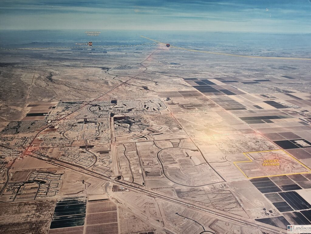
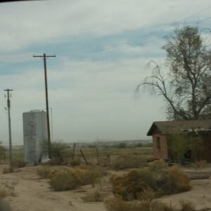
These aerial photographs from 2006, produced by Landiscor Aerial Information for KB Home, promoted the planned Desert Passage subdivision along what was then Maricopa’s eastern edge.
They show a version of Maricopa that looks very different from today. Across White and Parker Road, the land where Maricopa City Hall now stands is still farm fields. Across Bowlin Road, the future Central Arizona College campus is farmland as well. The Edison Pointe shopping center, home to Goodwill, Petco and Ross, is marked “future retail.”
The maps also label nearby landmarks that help orient the scene, including The Duke golf club, Santa Rosa and Pima Butte Elementary Schools, and the University of Arizona agricultural campus.
The images preserve a few transportation-related tidbits from the time they were created. Maricopa-Casa Grande Highway is labeled as State Route 238, though it was never under state jurisdiction. Some older maps unofficially dubbed it a continuation of SR 238 because it runs parallel to the Union Pacific railroad tracks. Loop 202’s South Mountain Freeway is only a proposed route across the Gila River Indian Community; that freeway would later open in 2019.
Desert Passage is now almost built out, with 750 homes on 770 lots.
When the subdivision was first launched, it became the city’s easternmost. Today, however, tens of thousands of residents live east of it. Neighborhoods such as Rancho Mirage, Sorrento and Tortosa have located farther east, while Anderson Farms is still ramping up development. Meanwhile, construction began in 2025 on the Ironwood Ranch apartment complex and the Elena Trails neighborhood, which lies entirely east of Murphy Road and is now Maricopa’s easternmost neighborhood.
Longtime Maricopa Realtor Brian Petersheim Sr. also recalls that much of nearby Desert Cedars was located within a flood zone when the subdivision began development. FEMA revised its flood maps a few years after these images were captured.
Maricopa’s eastern population boundary now sits about 3½ miles east of Desert Passage. Measured the other direction, that same distance west from Desert Passage would put you outside city limits, beyond Alterra — a reminder of how much the city’s footprint shifted in 20 years.

![A dancer dressed in jingle dress regalia, dances during Maricopa Elementary School PTO's inaugural social powwow on May 2, 2026. [Monica D. Spencer]](https://inmaricopa.com/wp-content/uploads/2026/06/20260502-spencer-mes-social-powwow-22-300x200.jpg)


![A dancer dressed in jingle dress regalia, dances during Maricopa Elementary School PTO's inaugural social powwow on May 2, 2026. [Monica D. Spencer]](https://inmaricopa.com/wp-content/uploads/2026/06/20260502-spencer-mes-social-powwow-22-150x150.jpg)


One Response
Nice images!!!😆😆😆